Code of Safe Navigation
 The Oban Bay Management Group (OBMG) has been working with the local community to revise the Code of Practice for users of Oban Bay. This latest revision comes into effect from 31 March 2019. The information below is compatible with and complementary to the Code.
Masters and skippers should be familiar with this information and advice before arrival and use it to remain safe and enjoy their time in Oban.
There is a dedicated Leisure Guide for small vessels, issued from March 2019, which summarises the key points to enjoying your visit to Oban.
Communications
All vessels should monitor VHF Channels 16 & 12 when operating in Oban or the approaches.
The Oban Harbour callsign on VHF channel 12 will be answered by the Harbour Master at North Pier during the working day and the CalMac Piermaster at Railway Pier and South Pier during out of hours periods.
See VHF radio reporting procedures for more details.
Leisure Traffic
Small vessels of less than 20m in length and all sailing vessels should not impede the safe passage of a large vessel entering or leaving the bay. They should avoid using the designated large vessel channel that runs through the centre of the north entrance. Small vessels are reminded that they may be very difficult to see and that the North Channel is a blind bend to ships navigating along it.
The following basic requirements should be met:
- Do comply with the International Regulations for Preventing Collisions at Sea (COLREGS).
- Do keep below 10 Knots in the outer part of Oban Bay and the sound of Kerrera.
- Do keep below 6 knots in Oban Harbour
- Do keep a good lookout and act with due consideration to others.
- Do give way to all vessels over 20 metres in length and vessels constrained by draught that are using the large vessel channel, e.g. ferries, cruise liners, fishing vessels, large yachts, etc.
- Do have your engine(s) running and ready for use when entering / leaving Oban Bay if your sailing vessel is fitted with engine(s).
- Do secure properly to your mooring or berth and use adequate fendering.
- Do follow the Slipway Safety and RNLI Safety at Sea Guidance displayed on the slipway.
- Do report safety incidents to the Oban Bay Harbour Manager, using the incidents reporting page on this website.
- Do not loiter near large vessel routes, especially in the large vessel channel at the north entrance.
- Do not linger off the slipways or moorings.
- Do not water-ski, jet-ski, wind surf or kite-surf in Oban Bay or Harbour.
- Do not dive in Oban Bay or Harbour except with the permission of the Harbour Master.
- Do not exceed the stated speed limits.
Yacht Races
On a few occasions during the summer, major yacht races start in the bay off Oban Sailing Club, and leave the bay by either the north or the south entrances. These races, including the Scottish Islands Peaks Race in May and the Round Mull Race in early July, many involve upward of 50 yachts. The International Regulations for the Prevention of Collison at Sea will continue to apply to racing yachts and all other vessels. However, those vessels not taking part in the race are asked, if possible, to allow the racing fleet room to manoeuvre in the bay at the start of the race and to exit the bay unhindered for the short time they will require. Such races will be notified in advance to the principal harbour users and details will be published on the website.
Navigation Advice
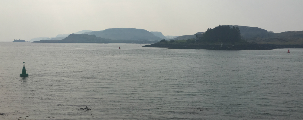
Oban Bay is bounded; to the north, by a line drawn between the western edge of Maiden Island and the north western tip of Kerrera; and to the south, by an east-west line drawn through Sgeirean Dubha Light, at the southern end of the Sound of Kerrera.
Oban Harbour is not a statutory harbour authority (SHA) but has the Argyll & Bute Council SHA, at North Pier and the CMAL SHA, at Railway Pier and South Pier. The defined Oban Harbour area, for the purposes of the Code of Practice, is the area east of a line between the war memorial at Dunollie and the boat house at Brandystone.
Charts
Admiralty Standard Charts Area 5 "Scotland – West Coast"
1790 Oban and Approaches (Edition 7 due 20 June 2019)
ENC (GB 50783B) or High Density large scale ENC (GB 6H0001)
Hazards within Oban Bay
Please note all buoyage is northward in direction within Oban Bay.
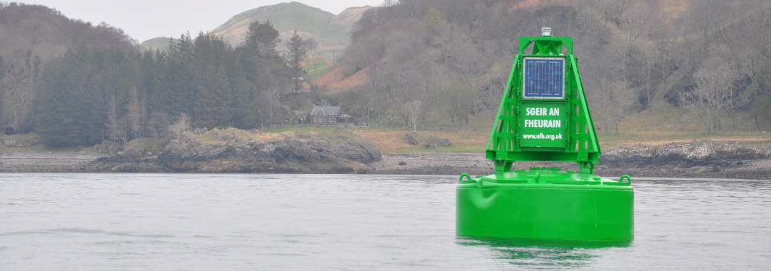
North side: The Corran Ledge, which dries at low water, is indicated by a line of 5 starboard lateral marks, which flash green simultaneously. Do not pass inside (to the north) of these buoys.
 Corran Ledge
North entrance
The north east tip of the Island of Kerrera, Rubh a Chruidh, is marked by 2 port lateral marks. These flash red simultaneously with the starboard lateral marks.
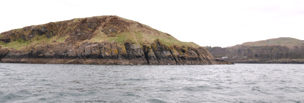
Looking south west from Dunollie Lt at Rubh a Chruidh
South side: (flashing) North & South Cardinals indicate the location of Sgeir Rathaid which dries at extreme low water.

Sgeir Rathaid
Ardantrive Bay: Off Oban Marina, on the Isle of Kerrera, there is a wreck at the most southerly point at Mount Pleasant. The wreck is visible at most states of tide and is marked by an unlit post off its northerly point.

Wreck off Kerrera
Approach to Oban Bay from the North:
Including from the Caledonian Canal, Mull, Hebrides, Minch
On entering the channel, you are advised to pass west of Maiden Island unless you are familiar with the area. Keep to the starboard side as much as possible and remain west of the Corran Ledge west cardinal buoy.
Maiden Island
Approach to Oban Bay from the South:
Including from the Crinan Canal, Islay, Jura, Clyde Coast, Ireland
Approach along Kerrera Sound which has well-marked hazards and buoyage. Proceeding with the direction of buoyage, i.e. for the north flooding tide, vessels are recommended to transit west of Ferry Rocks leaving Ferry Rocks northwest green lateral buoy to starboard. In poor visibility or in the dark, mariners may prefer to come up the seaward side of Kerrera and enter the Oban Bay from the North.
 Ferry Rocks
Narrow Channel
In order to reduce the risks of incidents between large commercial vessels and small leisure craft the whole area defined in the Code for Safe Navigation document (and shown on Admiralty chart 1790), which includes the North and South entrances to Oban Bay, shall be deemed to be Narrow Channels in accordance with Rule 9 of the COLREGS.
Large Vessel
A large vessel shall be defined as a vessel of more than 20 metres in length or with a draft in excess of three metres.
Large vessels entering or leaving Oban Bay shall keep as near to the starboard side of the channel as is safe and practicable.
Commercial Traffic
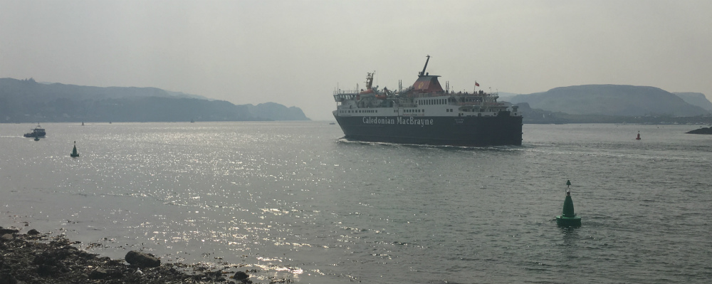
Oban is a key hub for CalMac ferries serving Mull, Colonsay, Coll, Tiree, Barra and Lismore from the Railway Pier. There are frequent ferry movements throughout the year, particularly in the summer and mariners should keep a good radio watch on Ch16 & Ch12 and an all round visual watch. Other large commercial and fishing vessels use the North and South Piers.
See the separate section on Ferries and guidance on how to minimise the risk of an incident with them.
Speed
Every vessel should proceed at a safe speed entering / within / leaving Oban Bay appropriate to the prevailing circumstances and conditions such as:
- The capability of a vessel to manoeuvre safely in the prevailing weather, sea and tidal conditions
- Other vessels in the vicinity
- The need to avoid adverse environmental impacts, such as wash impacting on and/or near adjacent shores
- Any emergency situation
A sailing vessel with engine(s) should have these running and ready for use when entering / leaving Oban Bay, especially via the north channel.
On approaches and within Oban Bay a safe speed is considered to be up to 10 knots through the water. The Oban Harbour speed limit is 6 knots.
International Regulations for the Prevention of Collision at Sea (COLREGS)
Masters, skippers and crew of ALL vessels must familiarise themselves with and comply with the International Regulations for the Prevention of Collision at Sea 1972, as amended, (COLREGS), Local Notices to Mariners and relevant Byelaws.
The COLREGS are published in Merchant Shipping Notice No. 1642/COLREG 1. Rules 2, 5, 6, 8, 9, 18 and 28 should be noted in particular, and are reproduced below for ease of reference.
Download the COLREGS pdf document »
Vessel Navigation Lights / Day Marks
It is recommended that large vessels, when constrained by narrow channels or by draught, display the signals prescribed in Rule 28 of the COLREGS, i.e. three all-round red lights in a vertical line, or a cylinder, in order to be afforded the privileges of Rules 8(f) (i) and (ii) (Actions to avoid collision), 9 (Narrow channels) and/or 18(d) (i) (Responsibilities between vessels when one is constrained by draught).